Engineering Portfolio

Mohammed Ismail Ali Attala

Senior Systems Engineer C4I/C2 Integration Tracking & Navigation

Engineering real-time tracking, navigation, and command-and-control solutions through mathematical modeling, sensor integration, embedded systems, and practical software development.

  1. 01Who I AmProfile, expertise & experience
  2. 02What I Have BuiltCompleted engineering projects
  3. 03What I Can Contribute NextFuture directions
Portrait of Mohammed Ismail Ali Attala
Tanta, Egypt

Part 01 · Who I Am

Professional Profile

Highly skilled Professional Engineer with extensive expertise in C4I systems, radar data fusion, and embedded Linux development.

Specialized in designing and implementing Multi-Target Tracking (MTT) algorithms and autonomous navigation systems for vehicles and drones. Experienced in real-time tracking solutions using Kalman filtering, geospatial visualization, and command-and-control communication architectures.

Seeking advanced technical opportunities in autonomous navigation, video and sensor fusion, tracking algorithms, and engineering R&D to contribute to innovative technologies.

Current role
Project Manager — C2 Systems Integration & Interface Management
Location
Tanta, Egypt
Degree
B.Eng. Communication & Electronics — University of Alexandria (2001)
Postgraduate
Diploma in Engineering Mathematics — University of Cairo (2015)

Professional highlights

  • C4I/C2 Systems Integration
  • Radar Tracking and Multi-Sensor Data Fusion
  • GPS Navigation and Real-Time Tracking
  • Embedded Linux and Systems Engineering
  • Engineering Training and Technical Leadership
  • Algorithm Development and Engineering R&D

Part 01 · Who I Am

Core Engineering Expertise

Capabilities organized by engineering domain — from sensor-level tracking to system-level integration and team leadership.

  • Command and Control Systems

    • C4I/C2 Systems
    • System Integration
    • Data Communication and Message Exchange
    • Network Architecture
    • System Interoperability
    • Interface Management
  • Radar Tracking and Data Fusion

    • Single-Radar Multi-Target Tracking
    • Multi-Sensor Data Fusion
    • Track Initiation and Maintenance
    • Plot-to-Track Association
    • Kalman Filtering
    • Alpha-Beta Tracking
  • Navigation and Geospatial Systems

    • GPS-Based Navigation
    • Vehicle Tracking
    • Geospatial Visualization
    • Route Playback and Analysis
    • Autonomous Navigation Concepts
    • Motion Estimation
  • Embedded Systems and Software

    • Embedded Linux
    • Linux System Administration
    • Python
    • C++
    • PyQt5
    • MySQL/MariaDB
    • Hardware and Software Integration
  • Systems Engineering and Leadership

    • Technical Project Management
    • Interface Management
    • System Installation and Integration
    • Technical Training and Mentoring
    • Contract Execution
    • Factory and Site Acceptance Testing

Part 02 · What I Have Built

Engineering Projects & Technical Demonstrations

Selected engineering projects demonstrating practical implementation in tracking algorithms, sensor integration, navigation, command-and-control systems, and real-time software.

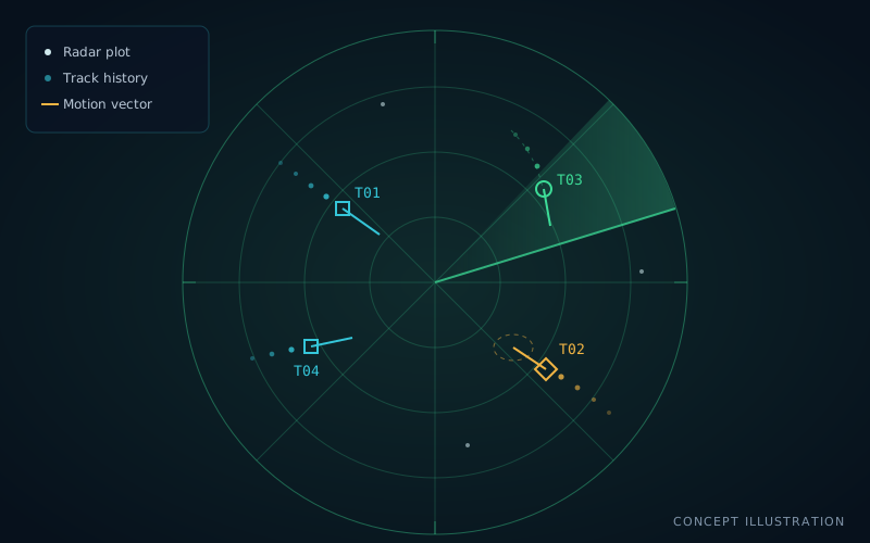
  • Concept illustration of a radar display with multiple target tracks, track histories and motion vectors Project image: single-radar multi-target tracking
    PROJECT 01

    Single-Radar Multi-Target Tracking

    Designed and implemented a single-radar multi-target tracking system using radar DSP outputs. Developed track initiation, prediction, and plot-to-track association logic to continuously update target position and motion for real-time tracking.

    • Radar Tracking
    • Track Management
    • Real-Time Processing
    Explore Project: Single-Radar Multi-Target Tracking
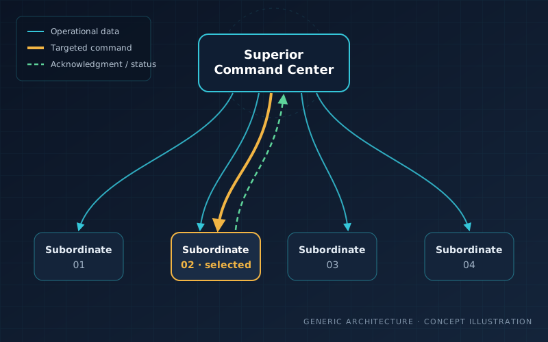
  • Concept illustration: a superior command center sending operational data to four subordinate units and a targeted command to one, with acknowledgment and status returning Project image: command and control data exchange
    PROJECT 02

    Command and Control Data Exchange

    Designed and integrated C2 data exchange within a C4I system linking a superior command center with four subordinate units: operational-data distribution, targeted commands, acknowledgment and execution-status feedback, shown as color-coded command states on synchronized displays.

    • C2 Systems
    • Command Acknowledgment
    • System Integration
    Explore Project: Command and Control Data Exchange
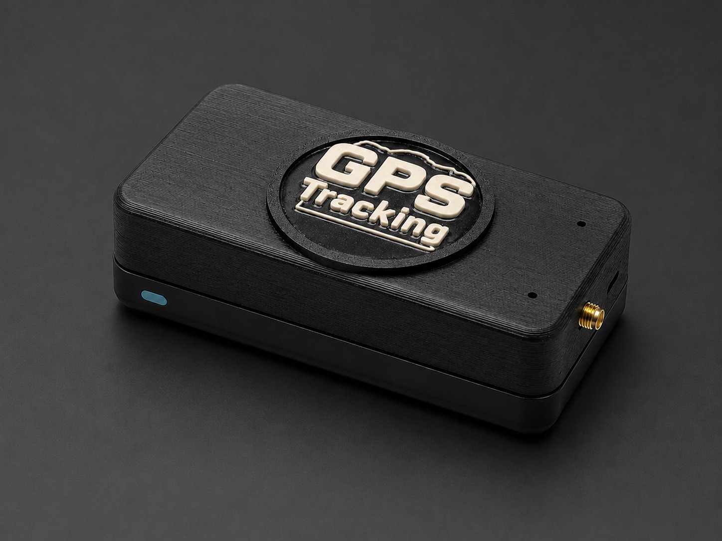
  • The GPS Tracking Version 01 unit: a black enclosure with a raised GPS Tracking emblem Project image: low-cost GPS-based navigation and tracking system
    PROJECT 03

    Low-Cost GPS-Based Navigation and Tracking System

    Designed and implemented a low-cost GPS navigation and fleet-tracking platform on a Raspberry Pi 4. Vehicles record trips locally like a black box; trips are replayed on a digital map and analyzed for speed violations, stops, distance and estimated fuel, offline or through an online version.

    • GPS Navigation
    • Fleet Tracking
    • Geospatial Analysis
    Explore Project: Low-Cost GPS-Based Navigation and Tracking System
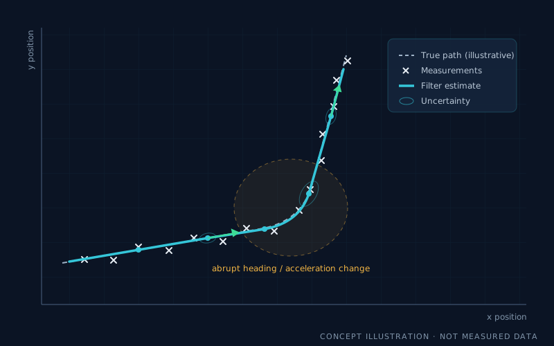
  • Concept plot of a maneuvering target: noisy measurements, an estimated track and an abrupt heading change Project image: adaptive Kalman filtering for maneuvering targets
    PROJECT 04

    Adaptive Kalman Filtering for Maneuvering Targets

    Developed an adaptive Kalman filter-based tracking algorithm for maneuvering targets: after a maneuver is detected, it shifts the predicted track position and recenters the validation gate, aiming to keep track through abrupt heading and acceleration changes with less computation than multiple-model approaches such as IMM.

    • Kalman Filtering
    • Adaptive Tracking
    • Maneuver Detection
    Explore Project: Adaptive Kalman Filtering for Maneuvering Targets
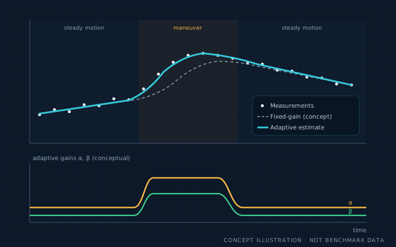
  • Concept illustration of target measurements, an estimated trajectory and adaptive filter gains responding to a maneuver Project image: adaptive alpha-beta tracking enhancement
    PROJECT 05

    Adaptive Alpha-Beta Tracking Enhancement

    Enhanced the standard alpha-beta tracker by replacing fixed parameters with an AI-based adaptive approach, aiming to improve tracking performance under different target motion conditions.

    • Alpha-Beta Filter
    • Adaptive Algorithms
    • AI-Assisted Tracking
    Explore Project: Adaptive Alpha-Beta Tracking Enhancement
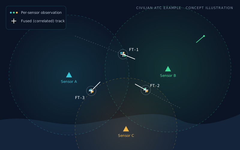
  • Civilian air-surveillance illustration: three sensors with overlapping coverage and consolidated fused tracks Project image: multi-target tracking with multi-sensor data fusion
    PROJECT 06

    Multi-Target Tracking with Multi-Sensor Data Fusion

    Developed a software-based multi-target tracking and multi-sensor data fusion project using Air Traffic Control (ATC) as a practical example to demonstrate how multiple surveillance sources can work together to build a unified air picture.

    • Multi-Sensor Fusion
    • Air Traffic Control
    • Track Correlation
    Explore Project: Multi-Target Tracking with Multi-Sensor Data Fusion

Project 03 shows its GPS tracking unit; the other images are original concept illustrations created for this portfolio, not screenshots of project software. Project screenshots will be added as they become available.

Part 03 · What I Can Contribute Next

Future Projects & Potential Contributions

Applying engineering experience, mathematical insight, and systems integration expertise to emerging challenges in tracking, navigation, autonomous systems, and engineering research and development.

The projects and cards below describe proposed directions and potential contributions to future projects and collaborative R&D. They are not completed or implemented systems, and no results are claimed for them.

Mohammed Ismail Ali Attala

Four planned R&D projects that I intend to lead, each extending completed work in radar tracking, multi-sensor fusion, C2 systems and GPS navigation into a new civilian domain. Every project has its own technical page with architecture, algorithms, mathematics, proposed hardware and software, evaluation metrics and a phased roadmap.

Planned Future Projects

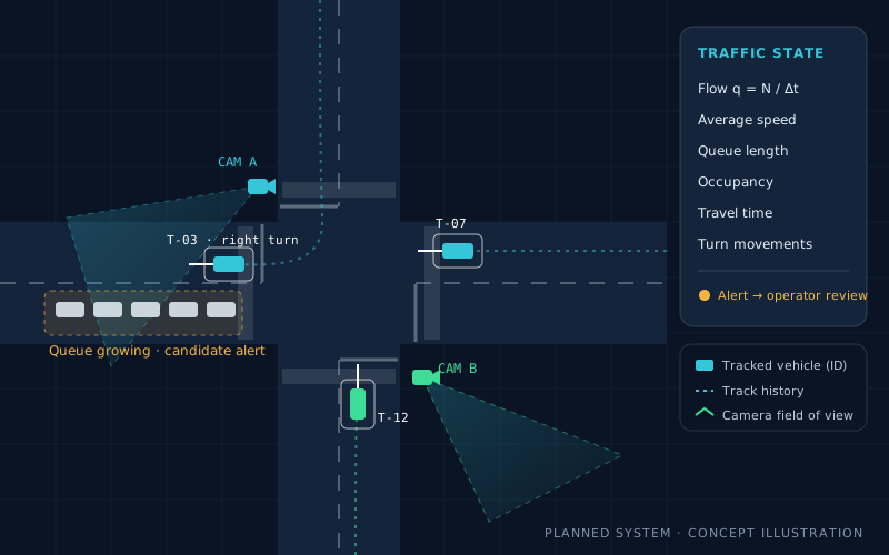
  • Concept illustration: an intersection watched by two cameras, with tracked vehicles, trajectory histories and a growing queue flagged as a candidate alert
    FUTURE PROJECT APlanned

    Ground Traffic Control System (GTCS)

    An ATC-inspired traffic platform that would turn road-camera video into a common traffic picture: vehicle detection, multi-object tracking, road-plane calibration, multi-camera fusion, traffic-state estimation and operator decision support — starting from one camera at one intersection.

    • Vehicle Tracking
    • Traffic-State Estimation
    • Decision Support
    Explore Project: Ground Traffic Control System (GTCS)
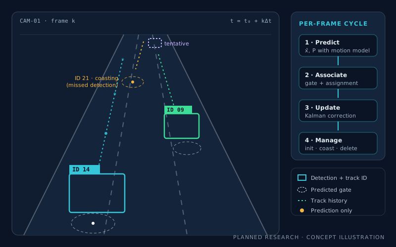
  • Concept illustration: a road camera frame with vehicles in labelled boxes, predicted gates and a coasting track, beside a predict-associate-update cycle
    FUTURE PROJECT BResearch Direction

    Video-Based Tracking & Multi-Sensor Perception

    Extending radar multi-target tracking into computer vision: detector-independent multi-object tracking with explicit track lifecycles, adaptive Kalman estimation for maneuvers, camera calibration for real-world motion, and camera–GPS/IMU fusion, benchmarked on accuracy, identity continuity and latency.

    • Computer Vision
    • Data Association
    • Kalman Filtering
    Explore Project: Video-Based Tracking and Multi-Sensor Perception
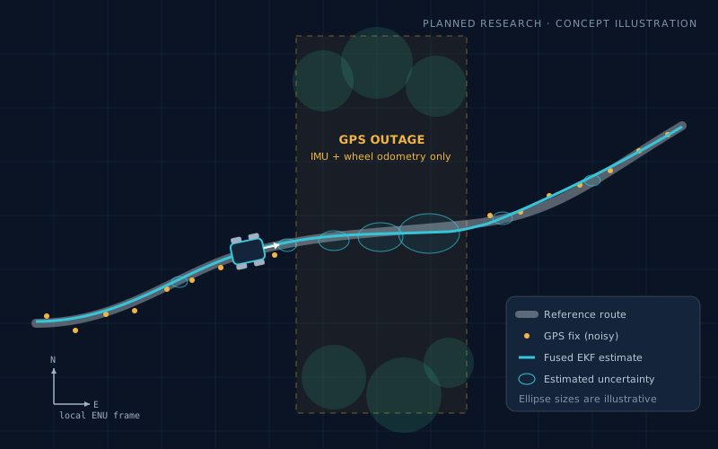
  • Concept illustration: a ground robot's fused GPS/IMU/odometry estimate through a GPS outage, with uncertainty ellipses growing and then contracting
    FUTURE PROJECT CResearch Direction

    Autonomous Navigation & Multi-Sensor Fusion

    Building on my GPS fleet-tracking platform: a ROS 2 state estimator on embedded Linux that fuses GPS/GNSS, IMU and wheel odometry with Kalman filtering, handles GPS outages with honest uncertainty, and grows toward LiDAR localisation and waypoint navigation on a ground-robot demonstrator.

    • GPS/IMU
    • Sensor Fusion
    • ROS 2
    • Navigation
    Explore Project: Autonomous Navigation and Multi-Sensor Fusion
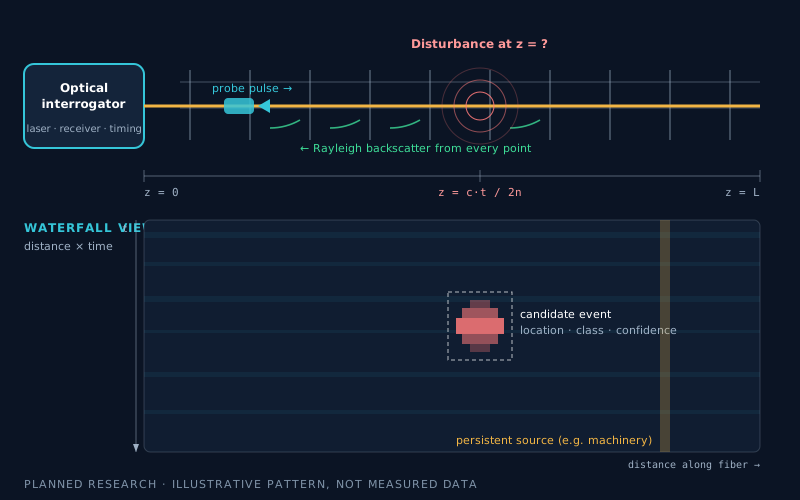
  • Concept illustration: an optical interrogator probing a fiber along a perimeter fence, with backscatter, a disturbance location and a distance-versus-time waterfall view
    FUTURE PROJECT DResearch Direction

    Intelligent Fiber-Optic Intrusion Detection System (iFIDS)

    Research into distributed fiber-optic vibration sensing: Rayleigh backscatter and DAS, event detection and localisation along the fiber, machine-learning classification and an operator interface — plus a measured feasibility study of whether a lower-cost interrogator can match a DAS-capable reference.

    • Distributed Acoustic Sensing
    • Signal Processing
    • ML Classification
    Explore Project: Intelligent Fiber-Optic Intrusion Detection System (iFIDS)

Project illustrations are original concept drawings, not screenshots or results. The earlier "Autonomous Navigation and Sensor Fusion", "Video-Based Tracking and Computer Vision" and "GPS/IMU Integration and Intelligent Transportation" directions are now covered in depth by Projects A–C.

Potential Contributions

  • Planned

    Advanced Tracking Algorithms

    Systematic, reproducible evaluation of estimation methods for dynamic tracking applications.

    • Investigate adaptive Kalman filtering, alpha-beta tracking, and other estimation methods for dynamic tracking applications.
    • Compare alternative algorithms using reproducible simulations and suitable performance metrics.
    • Explore the balance between tracking accuracy, computational complexity, and real-time processing.
  • Open for Collaboration

    Engineering R&D and Mathematical Knowledge Transfer

    Connecting engineering mathematics, implementation, and training within R&D teams.

    • Apply engineering mathematics to practical software and systems-development challenges.
    • Develop structured workflows connecting mathematical models, algorithms, software implementation, and verification.
    • Support technical mentoring, engineering training, and knowledge transfer within R&D teams.
  • Planned

    Systems Integration and Engineering Architecture

    Applying integration and interface-management experience to modular, verifiable architectures.

    • Contribute to modular software architectures, sensor interfaces, data communication, and system integration.
    • Develop reusable engineering components and test frameworks.
    • Support interoperability, maintainability, reliability, and systematic verification in complex engineering projects.

Who I Am · Career Record

Professional Experience

From radar operations and C4I installation to technical management, instruction, and C2 systems integration leadership.

  1. Project Manager — C2 Systems Integration and Interface Management

    Current role
    • Leads interfacing and integration activities for command-and-control systems across multiple operational levels.
    • Manages upgrades to security board systems to improve protection against unauthorized access and intrusions.
    • Supports reliable data exchange, system interoperability, and communication between hierarchical command units in mission-critical environments.
  2. Instructor — Automated Command and Control Systems

    • Delivered Linux system administration training.
    • Delivered MySQL database management training.
    • Delivered C++ and Python development training.
    • Supervised graduation projects simulating automated command-and-control systems, connecting theoretical concepts with practical implementation.
  3. Technical Manager — Radar and C4I Integration

    • Managed technical integration and interface activities between radar devices and C4I systems.
    • Worked on radar interface protocols and data interoperability.
    • Worked with Embedded Linux and developed the drivers needed for system integration.
  4. Responsible for C4I System Contracts

    • Managed procurement requirements and contract execution.
    • Negotiated commercial offers, balancing price and material quality.
    • Oversaw contract implementation and factory/site acceptance testing.
  5. C4I Systems Installation

    • Installed internal electrical networks, including power distribution, Automatic Transfer Switch (ATS) panels, and Uninterruptible Power Supply (UPS) units.
    • Installed and configured network switches and internal computer-network distribution.
    • Integrated radar devices to establish a comprehensive air situation picture.
    • Managed data communication links between sites, subordinate units, and higher command units.
    • Administered Linux systems.
    • Trained and mentored teams in their technical responsibilities.
  6. Training — C4I Systems

    NRIEE Institute and CETC (China)

    • Network engineering.
    • System administration.
    • Multi-Target Tracking (MTT) with multi-sensor radar data fusion to construct a unified air situation in Air Traffic Control (ATC) systems.
  7. Radar Engineer

    Radar site

    • Operated and maintained radar systems and power generators.
    • Gained practical experience in electronics troubleshooting and classical control principles.

Listed from the current role back to the earliest position.

Who I Am · Career Record

Education

  • 2001

    Bachelor of Engineering — Communication and Electronics

    University of Alexandria, Egypt

  • 2015

    Postgraduate Diploma in Engineering Mathematics

    University of Cairo, Egypt

Contact & Collaboration

Let's Discuss Engineering Opportunities

I welcome opportunities to collaborate on tracking and navigation systems, C4I/C2 integration, embedded systems, geospatial applications, and engineering research and development.